
File:1780 Raynal and Bonne Map of Southern India - Geographicus - Indes-bonne-1780.jpg

Size of this preview: 800 × 556 pixels. Other resolutions: 320 × 223 pixels | 640 × 445 pixels | 1,024 × 712 pixels | 1,280 × 890 pixels | 2,500 × 1,739 pixels.
Original file (2,500 × 1,739 pixels, file size: 1.08 MB, MIME type: image/jpeg)
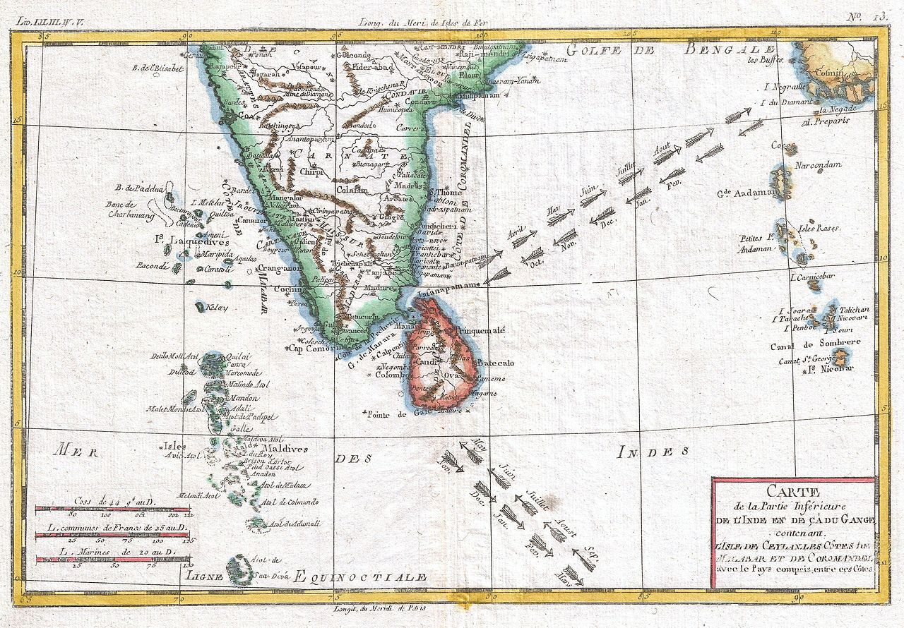
Rigobert Bonne: Carte De La Partie Inferieure De L'Inde En De Ca Du Gange
(   ) ) |
||||||||||||||||||||
|---|---|---|---|---|---|---|---|---|---|---|---|---|---|---|---|---|---|---|---|---|
| Artist |
|
|||||||||||||||||||
| Title |
Carte De La Partie Inferieure De L'Inde En De Ca Du Gange |
|||||||||||||||||||
| Description |
English: A fine example of Rigobert Bonne and G. Raynal’s 1780 map of Southern India. Includes the island of Sri Lanka as well as the Maldives and Andaman and Nicobar Island chains. Arrows in the Indian ocean show the direction of the trade wines in different seasons. Highly detailed, showing towns, rivers, some topographical features, ports and political boundaries. Drawn by R. Bonne for G. Raynal’s Atlas de Toutes les Parties Connues du Globe Terrestre, Dressé pour l'Histoire Philosophique et Politique des Établissemens et du Commerce des Européens dans les Deux Indes . |
|||||||||||||||||||
| Date | 1780 (undated) | |||||||||||||||||||
| Dimensions | height: 9 in (22.8 cm); width: 13 in (33 cm) | |||||||||||||||||||
| Accession number |
Geographicus link: Indes-bonne-1780 |
|||||||||||||||||||
| Source/Photographer |
Raynal, G., Atlas de Toutes les Parties Connues du Globe Terrestre, Dressé pour l'Histoire Philosophique et Politique des Établissemens et du Commerce des Européens dans les Deux Indes, 1780.
|
|||||||||||||||||||
| Permission (Reusing this file) |
|
|||||||||||||||||||



File history
Click on a date/time to view the file as it appeared at that time.
| Date/Time | Thumbnail | Dimensions | User | Comment | |
|---|---|---|---|---|---|
| current | 08:33, 24 March 2011 | | 2,500 × 1,739 (1.08 MB) | wikimediacommons>BotMultichillT | {{subst:User:Multichill/Geographicus |link=http://www.geographicus.com/P/AntiqueMap/Indes-bonne-1780 |product_name=1780 Raynal and Bonne Map of Southern India |map_title=Carte De La Partie Inferieure De L'Inde En De Ca Du Gange |description=A fine example |
File usage
There are no pages that use this file.
