


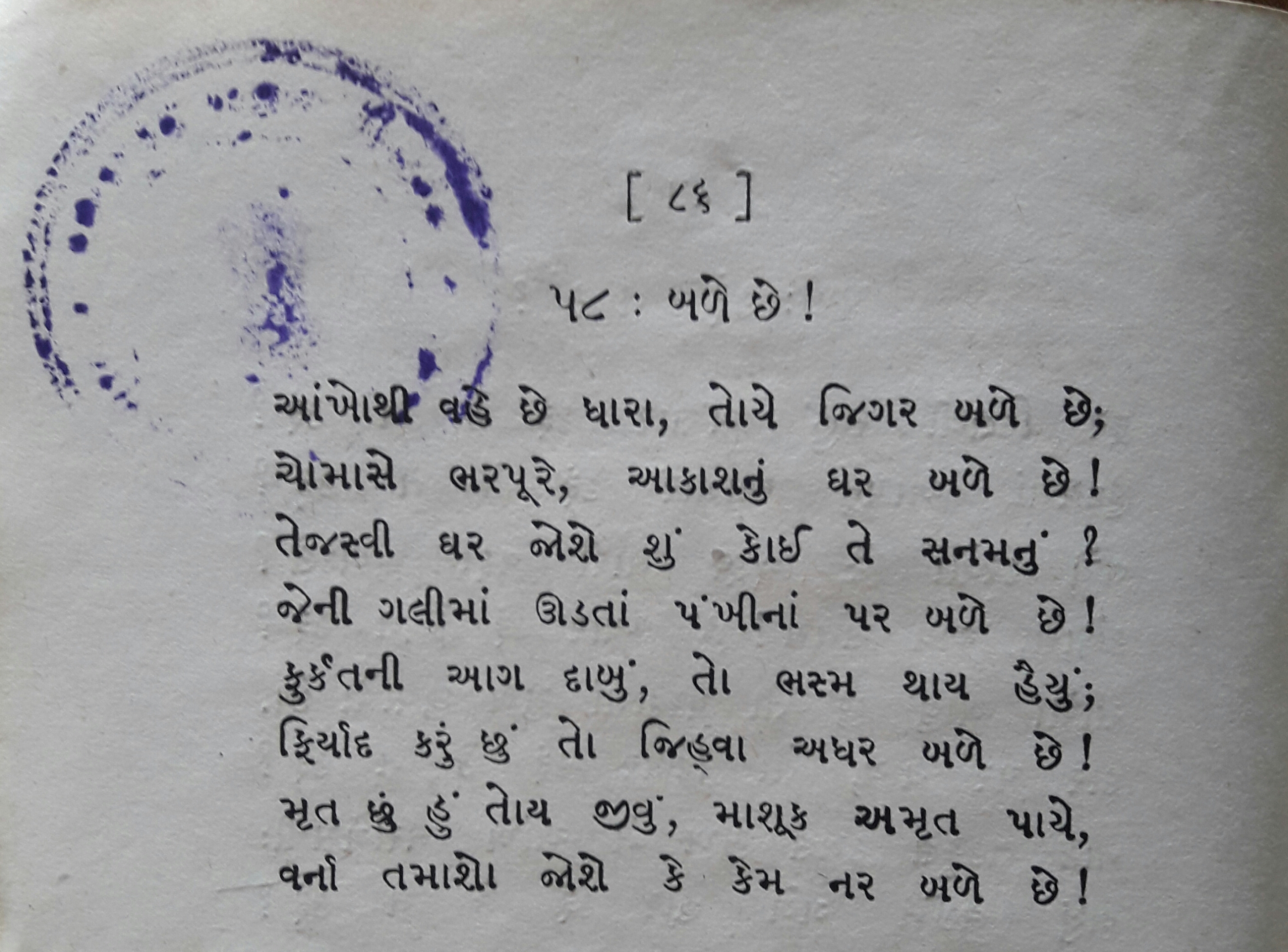
File:Ghazal of Amrit Keshav Nayak.jpg
Size of this preview: 800 × 591 pixels. Other resolutions: 320 × 236 pixels | 640 × 473 pixels | 1,024 × 757 pixels | 1,280 × 946 pixels | 2,560 × 1,892 pixels | 2,820 × 2,084 pixels.


Original file (2,820 × 2,084 pixels, file size: 2.91 MB, MIME type: image/jpeg)

Summary
| Description |
English: Aankho Thi Vahe Chhe Dhara, a Ghazal poem written by Indian poet Amrit Keshav Nayak (1877-1907). The poem is printed in the book (p. 86) "Gujarat Ni Ghazalo" (1943) edited by Krishnalal Jhaveri. |
| Date | |
| Source | Gujarat Ni Ghazalo (Ghazals of Gujarat), a book edited by Krishnalal Jhaveri |
| Author | Amrit Keshav Nayak |
| Camera location |  | View this and other nearby images on: OpenStreetMap |  |
|---|

Licensing

|
This work is in the public domain in India because its term of copyright has expired or it is ineligible for copyright.
The Indian Copyright Act applies in India to works first published in India. According to the Indian Copyright Act, 1957, as amended up to Act No. 27 of 2012 (Chapter V, Section 25):
 You must also include a United States public domain tag to indicate why this work is in the public domain in the United States. You must also include a United States public domain tag to indicate why this work is in the public domain in the United States.
|
 |
File history
Click on a date/time to view the file as it appeared at that time.
| Date/Time | Thumbnail | Dimensions | User | Comment | |
|---|---|---|---|---|---|
| current | 19:37, 1 April 2017 | | 2,820 × 2,084 (2.91 MB) | wikimediacommons>Gazal world | User created page with UploadWizard |
File usage
There are no pages that use this file.
