
File:Indo-Gangetic Plain.png
Size of this preview: 800 × 547 pixels. Other resolutions: 320 × 219 pixels | 640 × 437 pixels | 922 × 630 pixels.
Original file (922 × 630 pixels, file size: 467 KB, MIME type: image/png)


This file is licensed under the Creative Commons Attribution-Share Alike 2.5 Generic license.
- You are free:
- to share – to copy, distribute and transmit the work
- to remix – to adapt the work
- Under the following conditions:
- attribution – You must give appropriate credit, provide a link to the license, and indicate if changes were made. You may do so in any reasonable manner, but not in any way that suggests the licensor endorses you or your use.
- share alike – If you remix, transform, or build upon the material, you must distribute your contributions under the same or compatible license as the original.
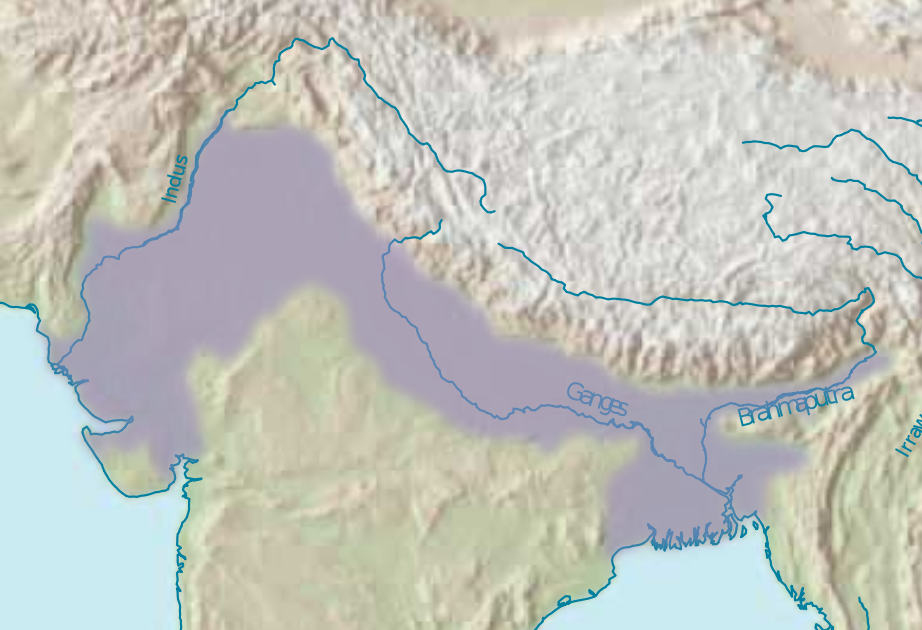
| Description | schematic map of the Indo-Gangetic Plain |
| Date | |
| Source | Asia.svg (uploaded by User:Sanao in the public domain, because it contains materials that originally came from the United States Central Intelligence Agency's World Factbook, and modified by User:Moyogo.) and I used the Bosatlas for information when things where not clear on the original map. |
| Author | Jeroen |
| Permission (Reusing this file) |
Public Domain |
| Other versions |
Derivative works of this file: |


File history
Click on a date/time to view the file as it appeared at that time.
| Date/Time | Thumbnail | Dimensions | User | Comment | |
|---|---|---|---|---|---|
| current | 19:00, 24 July 2007 | | 922 × 630 (467 KB) | wikimediacommons>Renamed user 73876485f2f7c42af5f2a33994cf3cb0 | {{PD-user-w|commons|Commons|Sanao}}. {{Information |Description= schematic map of the Indo-Gangetic Plain |Source= Image:Asia.svg and I used the Bosatlas for information when things where not clear on t |

File usage
There are no pages that use this file.
