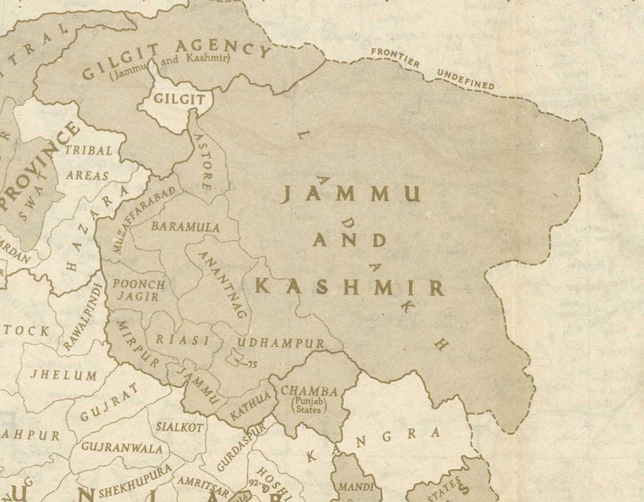
File:Jammu and Kashmir in 1946 map of India by National Geographic.jpg
Size of this preview: 769 × 599 pixels. Other resolutions: 308 × 240 pixels | 616 × 480 pixels | 985 × 768 pixels | 1,280 × 998 pixels | 1,551 × 1,209 pixels.
Original file (1,551 × 1,209 pixels, file size: 429 KB, MIME type: image/jpeg)
This file is from Wikimedia Commons and may be used by other projects. The description on its file description page there is shown below.
Summary
| DescriptionJammu and Kashmir in 1946 map of India by National Geographic.jpg |
English: This is one of the last few maps of Jammu and Kashmir produced during the British Raj, just before the independence of India and Pakistan |
|||
| Date | ||||
| Source | http://pahar.in/wpfb-file/1946-political-subdivisions-of-india-by-national-geographic-jpg/ | |||
| Author | National Geographic | |||
| Other versions |
|
Licensing
| Public domainPublic domainfalsefalse |
This media file is in the public domain in the United States. This applies to U.S. works where the copyright has expired, often because its first publication occurred prior to January 1, {{{year}}}, and if not then due to lack of notice or renewal. See this page for further explanation.
|

||
This image might not be in the public domain outside of the United States; this especially applies in the countries and areas that do not apply the rule of the shorter term for US works, such as Canada, Mainland China (not Hong Kong or Macao), Germany, Mexico, and Switzerland. The creator and year of publication are essential information and must be provided. See Wikipedia:Public domain and Wikipedia:Copyrights for more details.
|
Captions
Jammu and Kashmir in 1946 map of India by National Geographic
Items portrayed in this file
depicts
1946
image/jpeg
439,188 byte
1,209 pixel
1,551 pixel
a1c9dbb600ef03e6b272cb0bb148f17fa8ad4502
File history
Click on a date/time to view the file as it appeared at that time.
| Date/Time | Thumbnail | Dimensions | User | Comment | |
|---|---|---|---|---|---|
| current | 20:48, 21 October 2020 | 1,551 × 1,209 (429 KB) | wikimediacommons>Kautilya3 | Uploaded a work by National Geographic from http://pahar.in/wpfb-file/1946-political-subdivisions-of-india-by-national-geographic-jpg/ with UploadWizard |
File usage
The following page uses this file:
Metadata
This file contains additional information, probably added from the digital camera or scanner used to create or digitize it.
If the file has been modified from its original state, some details may not fully reflect the modified file.
| Width | 8,100 px |
|---|---|
| Height | 8,584 px |
| Bits per component |
|
| Compression scheme | Uncompressed |
| Pixel composition | RGB |
| Orientation | Normal |
| Number of components | 3 |
| Horizontal resolution | 300 dpi |
| Vertical resolution | 300 dpi |
| Data arrangement | chunky format |
| Software used | Adobe Photoshop CS4 Macintosh |
| File change date and time | 14:12, 22 February 2013 |
| Color space | Uncalibrated |
| Image width | 8,584 px |
| Image height | 7,478 px |
| Date and time of digitizing | 05:51, 22 February 2013 |
| Date metadata was last modified | 07:12, 22 February 2013 |
| Unique ID of original document | xmp.did:F97F1174072068118DBBD514DEC43E34 |