


File:Kaprun - Lärchwandschrägaufzug.JPG
Size of this preview: 800 × 533 pixels. Other resolutions: 320 × 213 pixels | 640 × 427 pixels | 1,024 × 683 pixels | 1,280 × 853 pixels | 2,560 × 1,707 pixels | 3,900 × 2,600 pixels.


Original file (3,900 × 2,600 pixels, file size: 9.7 MB, MIME type: image/jpeg)

Summary
| Description |
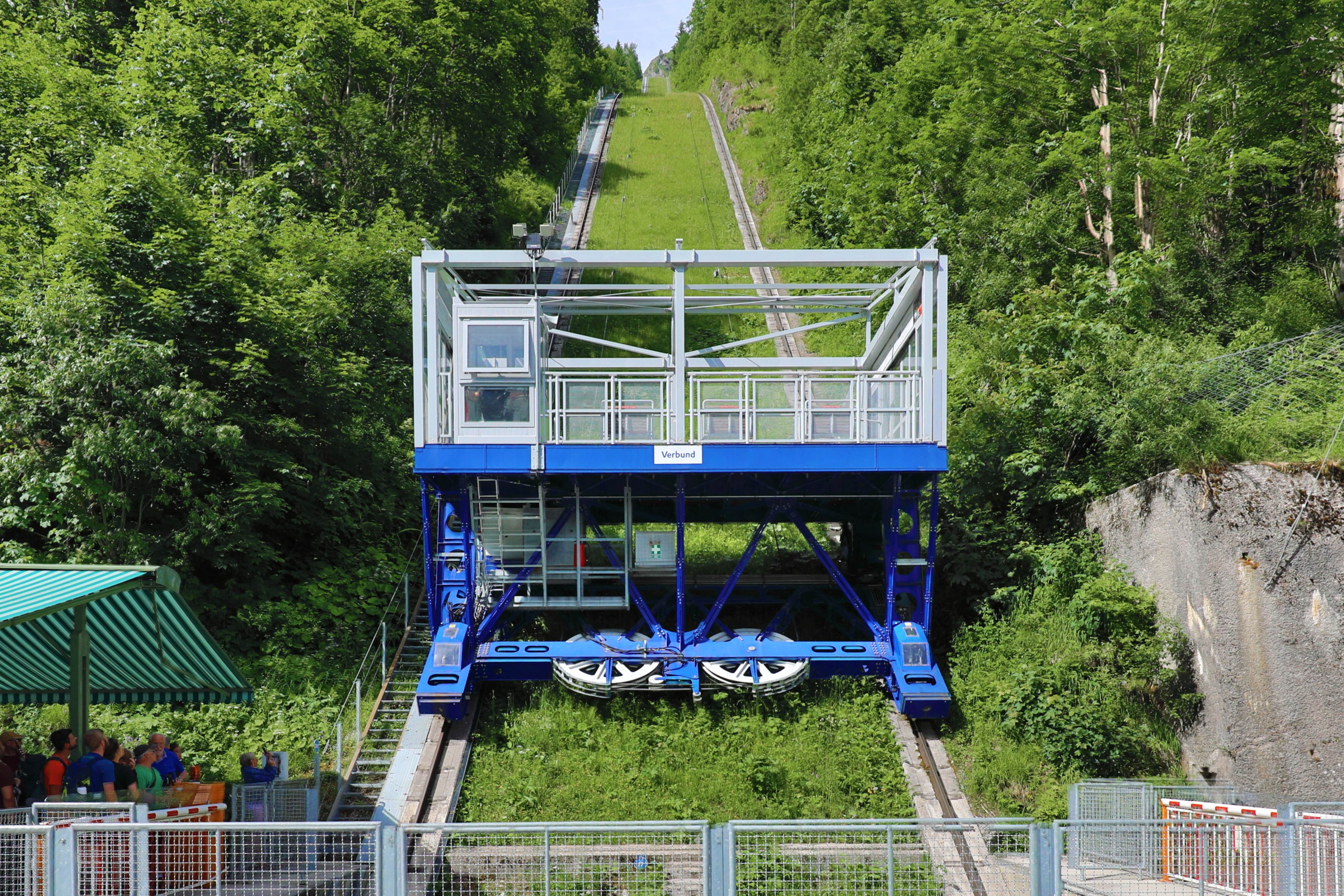
Deutsch: Der Lärchwandschrägaufzug in der Salzburger Gemeinde Kaprun.
Der Schrägaufzug wurde ursprünglich 1941 mit einer Spurweite von 3,6 m und eine Tragfähigkeit von 9 t von der Firma Waagner-Biro errichtet. 1952 erfolgte ein Neubau mit einer Spurweite von 8,2 m und einer Traglast von 60 t. Weil seit 2007 erstmals eine LKW-taugliche Zufahrt zum oberen Teil der Hochgebirgsstraße, der Mooserbodenstraße, über den neu errichteten Schranbachtunnel zur Kraftwerkskaverne Limberg II besteht, wird der Aufzug nur noch zum Personentransport bzw. für touristische Zwecke genutzt: [1]. Techn. Datenː Höhe Talstationː 1209 m, Höhe Bergstationː 1640 m, geneigte Längeː 810 m, Fahrzeitː 4ː10 min, Betriebsgeschwindigkeitː 3,6 m/s, Förderleistungː 900 Personen/h, Fassungsraum Fahrzeugː 185̟ Personen plus Fahrer. English: The inclined elevator "Lärchwandschrägaufzug" in Kaprun. |
| Date | |
| Source | Own work |
| Author | C.Stadler/Bwag |
| Permission (Reusing this file) |
Deutsch: Hallo, du darfst meine Fotos kostenlos nutzen, aber nenne mich bitte als Fotograf, beispielsweise „Foto: C.Stadler/Bwag“ oder © C.Stadler/Bwag; CC-BY-SA-4.0. Auf mehr Angaben bestehe ich nicht - im Gegensatz zu manch anderen, die die Vorgaben der unten angeführten Lizenzierung auf Punkt und Beistrich einfordern. English: Feel free to use my photos, but please mention me as the author like © C.Stadler/Bwag or © C.Stadler/Bwag; CC-BY-SA-4.0 (that's good enough) and if you want send me a message: bwag@gmx.net. |
| Object location |  | View this and other nearby images on: OpenStreetMap |  |
|---|

| Camera location |  | View this and other nearby images on: OpenStreetMap | |
|---|

Licensing
I, the copyright holder of this work, hereby publish it under the following license:


This file is licensed under the Creative Commons Attribution-Share Alike 4.0 International license.
- You are free:
- to share – to copy, distribute and transmit the work
- to remix – to adapt the work
- Under the following conditions:
- attribution – You must give appropriate credit, provide a link to the license, and indicate if changes were made. You may do so in any reasonable manner, but not in any way that suggests the licensor endorses you or your use.
- share alike – If you remix, transform, or build upon the material, you must distribute your contributions under the same or compatible license as the original.
File history
Click on a date/time to view the file as it appeared at that time.
| Date/Time | Thumbnail | Dimensions | User | Comment | |
|---|---|---|---|---|---|
| current | 21:07, 27 June 2023 | | 3,900 × 2,600 (9.7 MB) | wikimediacommons>Bwag | b |
File usage
There are no pages that use this file.
