
File:Punjab 1951-66.svg
Size of this PNG preview of this SVG file: 800 × 324 pixels. Other resolutions: 320 × 130 pixels | 640 × 259 pixels | 1,024 × 414 pixels | 1,280 × 518 pixels | 2,560 × 1,036 pixels | 1,055 × 427 pixels.
Original file (SVG file, nominally 1,055 × 427 pixels, file size: 50 KB)
Summary
| Description |
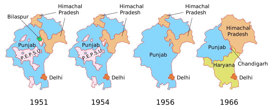
Deutsch: Territoriale Entwicklung des Punjab und benachbarter Bundesstaaten bzw. Unionsterritorien in Indien zwischen 1951 und 1966:
English: Territorial evolution of Punjab and neighbouring states and Union territories in India between 1951 and 1966. |
| Date | |
| Source | Own work using data from the Census of India |
| Author | Furfur |
| Permission (Reusing this file) |
I, the copyright holder of this work, hereby publish it under the following license:    This file is licensed under the Creative Commons Attribution-Share Alike 4.0 International license.
|
| Other versions |
[]
|


File history
Click on a date/time to view the file as it appeared at that time.
| Date/Time | Thumbnail | Dimensions | User | Comment | |
|---|---|---|---|---|---|
| current | 12:24, 25 December 2020 | No thumbnail | 1,055 × 427 (50 KB) | wikimediacommons>Ibrahim.ID | Reverted to version as of 17:40, 2 March 2019 (UTC) |
File usage
There are no pages that use this file.
