
File:South Africa racial map, 1979.gif
Size of this preview: 767 × 600 pixels. Other resolutions: 307 × 240 pixels | 614 × 480 pixels | 940 × 735 pixels.
Original file (940 × 735 pixels, file size: 249 KB, MIME type: image/gif)
Summary

|
This ethnographic map image could be re-created using vector graphics as a SVG file. This has several advantages; see Commons:Media for cleanup for more information. If a SVG form of this image is available, please upload it and afterwards replace this template with
{{vector version available|new image name}}.It is recommended to name the SVG file “South Africa racial map, 1979.svg”—then the template Vector version available (or Vva) does not need the new image name parameter. |
| Description |
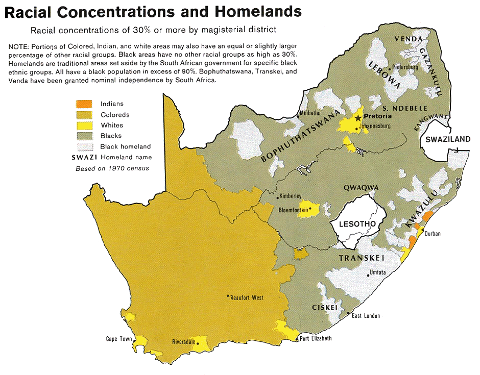
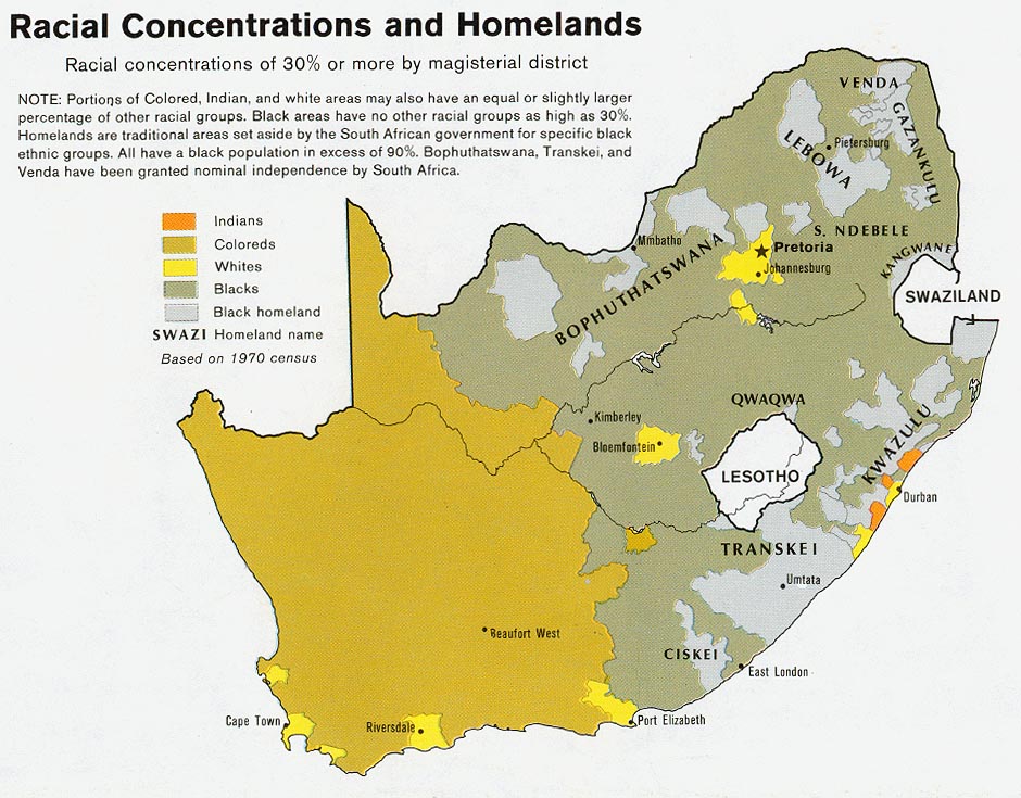
Afrikaans: Rassedemografie van Suid-Afrika volgens 1970-sensusdata
English: Map showing the territorial four main races/ethnicities/colors of South Africa in 1979: Whites, Coloureds, Blacks and Indians. The gray areas indicate the Apartheid-era Bantustans, which are almost exclusively black.
This map is a photoshopped version of the CIA-made original map at Perry Castañeda map collection at the University of Texas website. |
| Date | |
| Source |
Transferred from en.wikipedia to Commons by Magnus Manske using CommonsHelper. (Original text : * Site: Perry-Castañeda Library Map Collection: South Africa Maps |
| Author | U.S. Central Intelligence Agency |
| Permission (Reusing this file) |
Public domain |
| Other versions |
 |



Licensing

|
This image is a work of a Central Intelligence Agency employee, taken or made as part of that person's official duties. As a Work of the United States Government, this image or media is in the public domain in the United States.
|

|
Original upload log
The original description page was here. All following user names refer to en.wikipedia.

- 2008-08-23 06:02 MaGioZal 940×735× (254595 bytes) Map showing the territorial four main races/ethnicities/colors of South Africa in 1979: [[South African Whites|Whites]], [[Colored (South Africa)|Coloreds]], [[South African Blacks|Blacks]] and [[South African Indians|Indians]]. The gray areas indicate th
File history
Click on a date/time to view the file as it appeared at that time.
| Date/Time | Thumbnail | Dimensions | User | Comment | |
|---|---|---|---|---|---|
| current | 20:50, 19 February 2011 | | 940 × 735 (249 KB) | wikimediacommons>File Upload Bot (Magnus Manske) | {{BotMoveToCommons|en.wikipedia|year={{subst:CURRENTYEAR}}|month={{subst:CURRENTMONTHNAME}}|day={{subst:CURRENTDAY}}}} {{Information |Description={{en|Map showing the territorial four main races/ethnicities/colors of South Africa in 1979: [[:en:Whites in |
File usage
There are no pages that use this file.
