





Template:More citations needed
Template:Infobox dam
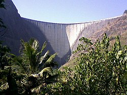
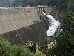
Kulamavu Dam is a gravity/masonry dam on Kilivillithode which is a tributary of the Periyar river Arakkulam Village in Idukki district of Kerala, India . It is one of the three dams associated with the Idukki hydro electric power project in the Indian state of Kerala.[1]This dam is located towards the western side of the Idukki Arch Dam.[2] This is a gravity dam with the top portion in concrete and the bottom in masonry. [3]
The dam is situated on the Thodupuzha - Puliyanmala state highway (SH-33), about Template:Cvt from Idukki arch dam, Template:Cvt from Cheruthoni dam and Template:Cvt from Thodupuzha. The dam was completed in the year 1977 and is operated and maintained by Kerala State Electricity Board.
The dams of Idukki, Cheruthoni and Kulamavu extend to an area of 33 km². The construction of these three dams formed a 60 km² artificial lake. The water stored in it is used for the production of electricity at the power house in Moolamattom.[4] [5] Taluks through which release flow are Thodupuzha, Udupanchola, Devikulam, Kothamangalam, Muvattupuzha, Kunnathunadu, Aluva, Kodungalloor and Paravur.
Specifications
- Type of Dam :Masonry & Concrete Gravity
- Classification : VH (Very High Dam )
- Panchayath : Arakkulam
- Village : idukki
- District : Idukki
- River Basin : Periyar
- River : Kilivallithodu
- Release from Dam to river : Kilivallithodu
- Length of Dam (m) : 385
- Max Height above Foundation (m) :100
- Total Volume Content of Dam (TCM) :453.13
- Design Flood (cumec) :8014 [6]
- Maximum Water Level (MWL) : EL 2408.50ft. ( 734.30 m)
- Full Reservoir Level ( FRL) : EL 2403.00ft. ( 732.62 m)
- Storage at FRL : 1996.30Mm3
- Spillway : No spillway
<mapframe text="Dams in Periyar" width="500" height="500" zoom="9" latitude="9.8696" longitude="76.8399" align="center"> [ {
 "type": "Feature",
 "geometry": { "type": "Point", "coordinates": [77.144167,9.528611, ] },
 "properties": {
   "title": "Mullaperiyar Dam",
  "description": "File:Mullapperiyardam.jpg",
   "marker-symbol": "dam",
   "marker-size": "large",
   "marker-color": "0050d0"
 }

}, {
 "type": "Feature",
 "geometry": { "type": "Point", "coordinates": [76.976111,9.842778 ] },
 "properties": {
   "title": "Idukki Dam",
   "description": "File:IdukkiDamConcaveSide.jpg",
   "marker-symbol": "dam",
   "marker-size": "large",
   "marker-color": "0050d0"
 }

}, {
 "type": "Feature",
 "geometry": { "type": "Point", "coordinates": [76.966944,9.845278] },
 "properties": {
   "title": "Cheruthoni Dam",
  "description": "File:Cheruthoni004.jpg",
   "marker-symbol": "dam",
   "marker-size": "large",
   "marker-color": "0050d0"
 }

}, {
 "type": "Feature",
 "geometry": { "type": "Point", "coordinates": [76.896111,9.802942] },
 "properties": {
   "title": "Kulamavu Dam",
  "description": "File:View on Kulamavu Dam Reservoir.jpg",
   "marker-symbol": "dam",
   "marker-size": "large",
   "marker-color": "0050d0"
 }

}, {
 "type": "Feature",
 "geometry": { "type": "Point", "coordinates": [ 77.124,10.106] },
 "properties": {
   "title": "Mattupetty Dam",
  "description": "File:Mattupetty Dam.jpg",
   "marker-symbol": "dam",
   "marker-size": "large",
   "marker-color": "0050d0"
 }

}, {
 "type": "Feature",
 "geometry": { "type": "Point", "coordinates": [76.9548034,9.962278] },
 "properties": {
   "title": "Lower Periyar Dam",
   "marker-symbol": "dam",
   "marker-size": "large",
   "marker-color": "0050d0"
 }
}, {
 "type": "Feature",
 "geometry": { "type": "Point", "coordinates": [76.9968439,9.9829676] },
 "properties": {
   "title": "Kallarkutty Dam",
   "description": "File:Kallar kutty005.jpg",
   "marker-symbol": "dam",
   "marker-size": "large",
   "marker-color": "0050d0"
 }

}, {
 "type": "Feature",
 "geometry": { "type": "Point", "coordinates": [76.705833,10.221667] },
 "properties": {
   "title": "Idamalayar Dam",
  "description": "File:Idamalayar Dam.jpg",
   "marker-symbol": "dam",
   "marker-size": "large",
   "marker-color": "0050d0"
 }

}, {
 "type": "Feature",
 "geometry": { "type": "Point", "coordinates": [77.1763,10.0218] },
 "properties": {
   "title": "Anayirankal Dam",
  "description": "File:Anayirankal dam.jpg",
   "marker-symbol": "dam",
   "marker-size": "large",
   "marker-color": "0050d0"
 }

}, {
 "type": "Feature",
 "geometry": { "type": "Point", "coordinates": [77.19,10.14] },
 "properties": {
   "title": "Kundala Dam",
  "description": "File:Kundala Dam and Lake.JPG",
   "marker-symbol": "dam",
   "marker-size": "large",
   "marker-color": "0050d0"
 }

}, {
 "type": "Feature",
 "geometry": { "type": "Point", "coordinates": [76.662222,10.136389] },
 "properties": {
   "title": "Bhoothathankettu",
  "description": "File:Bhoothathankettu Dam.jpg",
   "marker-symbol": "dam",
   "marker-size": "large",
   "marker-color": "0050d0"
 }

}
] </mapframe>
Resesrvoir
Hydroelectric project
This Underground Power Station is supposedly a technological achievement. There are six generating units each of 130 MW capacity. There are seven 220KV feeders for transmitting the power to the load centers. The power generated in the powerhouse is taken to the switchyard through 220 KV oil filled cables. After power generation, water from the power station is released to the Thodupuzha River through an underground tunnel which is 1220 meters in length. This tail race water is in turn used for producing electricity in the Malankara Small Hydro Electric Station and also for irrigation by means of Irrigation dam at Malankara. [7]
See also
- Cheruthoni Dam
- Idukki Dam
- List of reservoirs and dams in India
- Moolamattom Power Station
- Telefilm about Idukki Dam
References
- ↑ Dam. Retrieved 2017-05-06.
- ↑ ITTCOS | Idukki Taluk Tourism Development Co-operative Society Ldt No I-736. ittcosidukki.com. Retrieved 2021-07-23.
- ↑ Kerala State Electricity Board Limited - Periyar Basin Hydro Projects. www.kseb.in. Retrieved 2021-07-23.
- ↑ കേരളത്തിന്റെ ഊർജ ക്ഷേത്രത്തിന് ദേശീയ റെക്കോഡ്; അഭിമാന പദ്ധതി | Moolamattom power house.
- ↑ Kerala: Moolamattam power plant generates 10,000 crore units | Kochi News - Times of India. The Times of India. Retrieved 2021-07-23.
- ↑ http://india-wris.nrsc.gov.in/wrpinfo/index.php?title=Kulamavu(Eb)_Dam_D03334
- ↑ Kerala State Electricity Board Limited - Periyar Basin Hydro Projects. www.kseb.in. Retrieved 2021-07-23.