
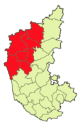
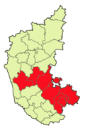

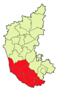
The Indian State of Karnataka is divided into 30 districts and 4 administrative divisions. The state is geographically consisted of 4 principal regions: the coastal region of Karavali, the hilly Malenadu region comprising the Western Ghats, Are Malnadu region of Kolar, Bengaluru and Tumakuru and the Bayaluseeme region comprising the plains of the Deccan plateau.
Administrative divisions
| Belagavi Division | Bengaluru Division | Kalaburagi Division | Mysuru Division |
|---|---|---|---|

|

|

|

|
Alphabetical listing of districts
.svg)
.svg)
.svg)
.svg)
.svg)
.svg)
.svg)
.svg)
.svg)
.svg)
.svg)
.svg)
.svg)
.svg)
.svg)
.svg)
.svg)
.svg)
.svg)
.svg)
.svg)
.svg)


References
- ↑ NIC Policy on format of e-mail Address: Appendix (2): Districts Abbreviations as per ISO 3166–2. Ministry Of Communications and Information Technology, Government of India(2004-08-18).
- ↑ 2.0 2.1 Know India — Districts of Karnataka. Government of India portal.
- ↑ Here 'Established' means year of establishment as a district of Karnataka. If the district was formed earlier to the formation of district in the state of Karnataka, 1 November 1956 will be considered as the day of establishment of the district.
- ↑ STATES REORGANISATION ACT 1956 - Formation of a new Mysore State.
- ↑ 5.0 5.1 List of districts of Karnataka
- ↑ 6.0 6.1 6.2 6.3 6.4 6.5 6.6 6.7 6.8 A Handbook of Karnataka — Administration. Government of Karnataka.
- ↑ Bagalkot district statistics- Area and Population.
- ↑ District Profile.
- ↑ District Profile — Area and population.
- ↑ Kolar district at a glance.
- ↑ Note: This date means the day when the district was initially formed, even before the formation of the state of Karnataka(Mysuru). Hence 1 November 1956 will be considered as the day of formation of district in the state of Karnataka
- ↑ Formation of Mandya district.
- ↑ Creation of Yadgir district. Online Edition of The Hindu, dated 2009-12-30(30 December 2009).